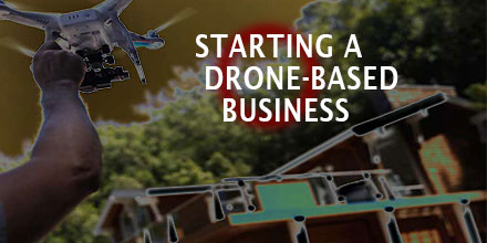
Drones have added a new dimension to a great number of industries and services. Once a pastime for RC enthusiasts, today this technology opens up new opportunities for entrepreneurs looking to start a business.
The real estate industry is one such sector that is taking advantage of the new technology.
It's easy to see how stunning, high definition aerial footage of a listing would benefit a realtor's marketing efforts. In fact, a growing number of realtor's are turning to this technology to gain a competitive edge, especially for their high-end listings. Drone enthusiasts have taken notice.
If you're considering a drone-based business geared towards the real estate industry, there are a number of factors to consider. Read on to learn the 6 top things to consider before you print those business cards.
Step One: Know the Rules and the Regs
It might seem like starting your business is as easy as purchasing a drone, opening the box and launching it into the sky. Well, not quite. In fact, besides securing the normal business licenses, it's important to understand what the FAA requires of all drone operators.
Did you know that there are
operational requirements for anyone who uses a drone to conduct business? This also includes the requirement to either hold a remote pilot airman certificate with a small UAS rating or be under the direct supervision of someone holding a remote pilot airman certificate.
To learn what the rules and regulations are and, most importantly, how they impact you, visit
Know Before You Fly. This non-profit organization is dedicated to educating prospective users about the safe and responsible operation of unmanned aircraft systems (UAS).
Step Two: Flight Proficiency and Safety
The next considerations are flight proficiency and safety; each are important for the initial and long-term success of your new venture. After all, work as a real estate drone photographer requires a high level of flying expertise. After all, this work involves flying in public places and over private property. One wayward move and the entire endeavor could end in disaster.
Flight safety classes area a great place to start.
Whether you take lessons from an approved instructor or decide to shadow an experienced pilot, it pays to put in the hours of practice. As mentioned above, the work of real estate aerial photography involves flying in public. As such, safety is crucial.
A flight safety class will also help you become familiar with your drone.
Once you or an appointed pilot are proficient in flying the drone it's time to consider the next step: choosing the aerial vehicle and equipment.
Step Three: The Right Drone and the Right Equipment
Before you purchase, ask yourself: what type of service do I want to provide? High definition video footage? Aerial photography? What equipment will I need to deliver those services?
There are countless drones and drone packages offered today. Your answers will help make your selection a bit more manageable.
The old adage remains true, you get what you pay for. Investing in a high quality drone usually means better flight capabilities and higher quality equipment. Take time to comparison shop to ensure you get the best bang for your buck.
Some drones come standard with gimbals and flight stabilization software. Others do not. Such equipment ensures the videos and photos you capture are as clear as possible - something that can give you an edge over your competitors.
Step Four: Market Research, Find a Niche and Establish Pricing
It is possible, with a little advanced work, to establish yourself as the go-to real estate photography expert in your area. To do so, it's going to take some research.
Find out who in your area is offering similar services and at what prices. Research how they are marketing their services. Do they have a website? Are they on social media platforms, if so, how are they using these platforms to sell their services?
As you determine pricing, make sure the packages take into account all the expenses you'll incur to provide this service. Consider any pilot fees, equipment costs and the like while maintaining reasonable fees for the area.
Don't limit yourself. There are other areas where your growing skills can be utilized in other industries such as building inspections or land surveying.
Step Five: Business Insurance
The drone industry is still in its formative years and, as of yet, there are no legal requirements for you to insure your drone. However, it is probably a sensible thing to do. From crashes to accidental fly-aways, there are a number of things that can go wrong in a drone related business.
It is also a good idea to meet with an insurance agent to find out how to best protect your entire business. After all, crashing a drone through a client's window is certainly a distinct possibility. Its best to have coverage that protects your business for any eventuality.
Getting your business insured may not seem worth it but consider the fact that damage to your drone or private property can put a hold on your business, or worse. Plus, it will give any potential clients peace of mind to know your insured.
Step 6: Keep an Eye on Costs
The main aim of starting your real estate photography business is to make money. It is easy to get carried away setting up a new business in an area you’re passionate about but a strong business mind is also required to succeed.
As such, it is important to keep an eye on costs. Keep expenditure to a minimum but at the same time never scrimp on quality as this will only affect your final results and customer satisfaction.
In your quest to create a successful business it is now also time to get the word out and acquire some clients. There are many ways to do this, including registering on drone services websites, reaching out to real estate companies, social media, and more. When reaching out to real estate offices persistence is important but remain courteous and professional as they can be quite busy.
The drone industry and its related business possibilities are still in their infancy. Creating a drone based business now will allow you to take advantage of future business opportunities. The tips above are a great place to start.
 Drones have added a new dimension to a great number of industries and services. Once a pastime for RC enthusiasts, today this technology opens up new opportunities for entrepreneurs looking to start a business.
The real estate industry is one such sector that is taking advantage of the new technology.
It's easy to see how stunning, high definition aerial footage of a listing would benefit a realtor's marketing efforts. In fact, a growing number of realtor's are turning to this technology to gain a competitive edge, especially for their high-end listings. Drone enthusiasts have taken notice.
If you're considering a drone-based business geared towards the real estate industry, there are a number of factors to consider. Read on to learn the 6 top things to consider before you print those business cards.

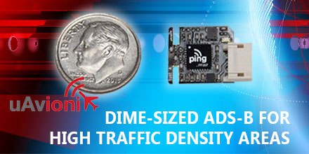 January 30, 2017 - uAvionix Corporation based in Palo Alto, California continues to innovate within the ADS-B transceiver market.
Today, uAvionix announced the development and test of a dime-sized transceiver weighing less than 1 gram.
UAvionix worked under a Collaborative Research and Development Agreement with the FAA and other partners to test this prototype.
 Today, thanks to a continued decrease in price, drones are now a fairly mainstream product. The skies, which were once the domain of experienced pilots, are filling with newbie operators trying their hand at drone flight.
As such, some have discovered that “ready-to-fly” – as many drones are marketed – can really mean, “ready-to-crash”. Of course, even veteran operators experience the odd mishap or two.
When it inevitably occurs, a crash can impact the vehicle in a number of ways – from slight damage to outright destruction or complete loss of the vehicle.
So, what should you do in the event your drone requires repairs?
While some may have the skill and confidence to make their own repairs, other may hesitate. After all, these technological wonders, though more affordable, still cost hundreds of dollars. For the hesitant, perhaps a professional drone shop is the answer.
But, what should you look for when choosing a shop? How do you get about getting your drone fixed? And how much will it cost?
Read on to discover answers to these commonly asked questions.
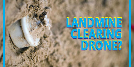 A landmine clearing drone may sound incredible. However, a fourteen-year-old from India has designed a machine that does just that – an anti-landmine drone that can detect and clear landmines.
Harshwardhan Zala found inspiration for his creation while watching news footage.
“I learned that a large number of soldiers succumb to injuries sustained due to landmine blasts while defusing them manually,” Zala said in an interview with the Times of India.
The news report got Zala's mind spinning. In response, Zala designed and constructed a drone to dispose of landmines in a safer manner with less risk to human life.
The first few vehicles were funded by Zala's parents.
“I started making drones on my own and set up an interface with a base station but realized I need to do more,” said Zala. “So I fixed payloads that detect landmines.”
Those small beginnings quickly changed when he won an innovation prize at the L.D. College of Engineering in Gujarat. Soon after, Zala found himself at Google headquarters where he was invited to share his invention with investors.
And most recently, the government of India at the Vibrant Gujarat Summit, granted the designer a contract to produce these drones for use in war zones.
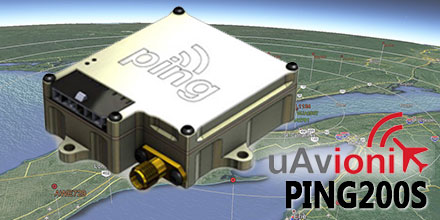 January 6, 2017 – uAvionix continues to roll-out innovative products within the Automatic Dependent Surveillance-Broadcast (ADS-B) arena.
Their latest addition? The Ping200S Mode S Transponder, which just received FCC approval.
The Ping200S provides a unique combination of small size, low power and high visibility. All these factors make it an ideal choice for drones and other beyond line of sight UAV operations.
“We are excited to offer Ping200S to the market,” said Paul Beard, CEO of uAvionix. “Until now, operators requiring a transponder had to choose between unlicensed devices or heavier, power-hungry legacy solutions.”
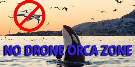 Legislation introduced in the state of Washington aims to limit drone interference for some very special residents…an endangered population of Orcas.
These Orcas, also known as the southern resident killer whales, are the smallest of four resident communities within the area. It is the only killer whale population listed as endangered by the U.S. Fish & Wildlife Service. In addition, they are protected under the Endangered Species Act.
The proposed bill requires drone operators to maintain a 200-yard buffer, in all directions, from any southern resident killer whales. This buffer already applies to boats, vessels and other objects that might encroach on the animals.
However, the existing law was unclear as to whether or not the line other objects applied to drones and other sUAS.
