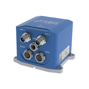
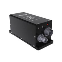
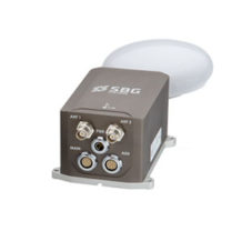
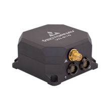
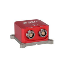
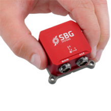
Ekinox-D: All-In-One INS/GNSS
Comes with one or two antennas and provides orientation, heave and centimeter-level position.
View cart
- Description
Description
Ekinox-D: All-In-One INS/GNSS
Ekinox-D is an all-in-one Inertial Navigation System with integrated RTK GNSS receiver ideal for applications where space is critical.
This advanced INS/GNSS comes with one or two antennas and provides orientation, heave and centimeter-level position.
High Performance for a Cost-effective Solution
- 0.02° Roll& Pitch (RTK)
- 0.05° Dual Antenna Heading
- 1 cm RTK GNSS Position @ 200 Hz
- Post-processing with Qinertia PPK Software
- 5 cm Heave; 2.5 cm Delayed Heave
- Ethernet, Serial and CAN interfaces
- ITAR-Free
- 2 Year Warranty
Need a smaller INS?
Consider the Ellipse2-D.
Ekinox Features
A Smart Balance of Accuracy and Price – Ekinox achieves the tactical grade in a compact and affordable package, thanks to a drastic selection of high end MEMS sensors, an advanced calibration procedure and powerful algorithm design.
Compact, Low-Weight, Low-Power – Ekinox is designed to offer a smart balance of performance in a compact, low-weight, and low-power but robust enclosure (IP68 for Surface version).
Internal Data Logger & Post-Processing – Ekinox sensors embed an 8 GB data logger for post-operation analysis or post-processing. Qinertia post-processing software enhances SBG INS performance by post-processing inertial data with raw GNSS observables.
Applications
Mobile Mapping
Cost-Effective and High-Performance INS for Mobile Mapping – An INS fuses inertial data (acceleration and turn rates) with GNSS to compute enhanced orientation and position. It allows precise data geo-referencing even when GNSS disturbances or outages occur and compensates inaccuracies due to the vehicle motion.
The INS also provides time-stamping and synchronize various mobile mapping instruments like cameras and LiDARs.
Antenna Pointing
Inertial Sensors for Antenna Pointing and SATCOM-On-The-Move – the INS provides real-time roll, pitch, and heading information used for antenna pointing application and vehicle heading.
The INS outputs filtered orientation (Pan/Tilt) and position remains robust in case of GPS/GNSS outages (trees, buildings, tunnels, etc.).
USV
Compact INS for Unmanned Surface Vessels – an all-in-one INS with a dual antenna GNSS receiver delivers a centimeter-level position (RTK) as well as roll, pitch and heading.
The INS additionally provides accurate heave data, automatically adjusted to the wave period. It is suited for USV navigation when GNSS outages occur and for precise payload stabilization such as echo-sounders.
Qinertia INS/GNSS Post-processing Software
Qinertia is the SBG Systems in-house post-processing software. This full-featured software enhances SBG inertial navigation systems performance by post processing inertial data with raw GNSS observables.
Learn more about Qinertia.
About SBG Systems
SBG Systems is a fast growing supplier of miniature, high performance and innovative motion sensing systems. They offer a complete line of inertial sensors based on state-of-the-art MEMS technology such as Attitude and Heading Reference System (AHRS), Inertial Measurement Unit (IMU), Inertial Navigation Systems with embedded GPS (INS/GPS), etc.

