How drones are turning the tide on coastal monitoring
 New and emerging technologies tend to enhance existing industries and services. In addition, emerging technologies also help create new industries and services.
Unmanned aerial vehicles are one of the biggest trends due in part to their potential use across a range of service and industry applications.
One such emerging application is coastline monitoring.
Drones help fight the tide
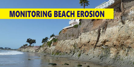
There are many reasons why coastlines are under threat but climate change is widely seen as one of the biggest causes of beach erosion. A number of companies are starting to use drone technology for many coastal monitoring applications.
The issue of protecting coastlines is a critical one in many countries across the globe. In the UK alone, over a million residential and commercial properties, as well as thousands of hectares in agricultural land lie within areas that are at the mercy of unpredictable changes.
Undertaking coastal protection studies requires careful monitoring of any changes that occur. The most efficient solutions for arresting and reversing erosion of coastlines also requires an understanding of existing environmental factors and their effect on the affected beaches. Monitoring thousands of miles of coastline, though, is a tough ask especially in an era of dwindling financial resources.
Effective solutions are gleaned through careful consideration of the above factors combined with any available historical knowledge and data. In effect, this is where emerging technologies like unmanned aerial vehicles come in.
Coastal monitoring drones
Drones are quickly becoming an invaluable tool to both monitor and help maintain the health of coastlines around the world. UAVs provide many advantages for this application.
One such advantage is a drone’s ability to cover increasingly large distances in a single flight. Plus, when outfitted with the right equipment, drones can capture highly detailed images and footage. The data harvested on these mission can, in turn, help inform decision making.
An additional advantage of using UAVs for coastline monitoring is the elimination of any human risk. For example, drones can quickly conduct an initial survey to assess damage after large storm events.
UAVs can also monitor potentially dangerous situations, such as the stability of cliffs, from a safe distance. Additionally, UAVs can keep track of beach erosion by measuring land volume and capture changes in coastal vegetation states.
Matching the drone to the environment
One company, QuestUAV, is demonstrating how new technologies can help tackle serious issues like environmental degradation. Their coastal monitoring work has helped local communities slowly reclaim lost beaches and coastlines.
The harsh environment of the North Sea seemed a fitting place to test the feasibility and durability of drones for coastal monitoring.
Wind speeds on the North-Eastern shores of the North Sea frequently reach up to 65 mph. Quest’s UAV platform features an airframe design with gimballed sensors and high spatial accuracy to ensure good data quality even in the difficult conditions. Plus, its use of Post Processing Kinematic (PPK) technology allows for detailed survey mapping.
PPK technology allows the mapping of coastal areas with up to 2cm spatial accuracy without relying on Ground Control points. Given the difficulty in placing ground control points in landscapes such as coastal dunes and cliffs, PPK technology provides a faster and more economic way to achieve great results.
Read about when and why our partner, Altavian, chooses to use PPK over RTK.
Surveying remote and challenging environments
In addition to coastline monitoring, the company conducted geological rock and cliff surveys, monitored sea color changes, and inspected breakwaters. They’ve also monitored industrial applications based in remote environments such as mining sites and power stations.
The company has kept track of the Northumberland Coast in the U.K. since 2008. In that time the area has suffered two major storms; one at the end of 2013 and another in the first month of 2017.
In the aftermath of the most recent storms, QuestUAV deployed so as to immediately assess the damage. The information gathered is used in conjunction with historical data, satellite imagery and models created in 3-D to ensure an accurate compilation of current conditions.
The future of coastal monitoring
Most experts agree that climate change is one of the biggest challenges to face mankind in recent memory. Beach erosion is one of the symptoms of the phenomenon. The use of drone technology can go a long way in the effort to help protect beaches and coasts around the world from being claimed by the sea.

