Vendor News

HFE Presents at Propulsion Conference

Recently, Tom West, CEO of HFE International, participated in the 9th Annual Conference on Propulsion Technologies for UAVs.

Held at Technion University in Haifa, Israel -- the event is attended by participants from around the world.  

Conference Scope

This one day event provides a platform to collaborate and discuss the latest technologies in UAV propulsion. It brings together researchers, scholars, commercial entities, and policy makers alike.

Students and engineers interested in UAV propulsion are also welcome to attend the Conference.

The aim of the Conference is to share knowledge and ideas. As such, lectures cover a wide range of technologies relevant to UAV propulsion -- from new battery chemistry to IC engine advancements. 

Learn more about the Conference on Propulsion Technologies for UAVs.

HFE Participation

This year, West received an invitation to participate as a presenter. West's lecture focused on the effects of torque impulse. 

In particular, West discussed the importance of managing vibration, improving hardware for shock and vibration. Plus, he introduced HFE International's all-in-one solution: the GenPod.

The GenPodTM includes all the necessary electronics, fuel pumping system, EFI system, ignition, and even motor mount isolation.

When it is time for your TBO overhaul, users simply swap the GenPodTM out for a new one. Thereby, nearly eliminating flight operational down-time.

About

Founded in 2010, HFE International develops and manufactures high end propulsion systems for UAV’s, drones, unmanned systems, and ground support equipment. These propulsion systems include fuel-injection and rotary systems with gasoline and multi/heavy fuel operation.

Shop HFE International's line of propulsion solutions at Unmanned Systems Source.

D3060 Light for Small Drones

D3060 Light for Small Drones

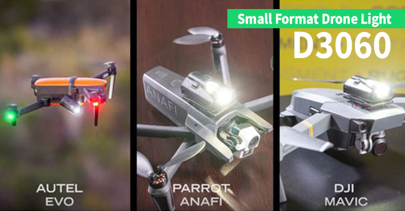
Recently, FoxFury Lighting Solutions introduced the D3060 light for small drones to their product offering.

D3060 is compact enough to fit on small format drones, such as the DJI Mavic, Autel Evo, and Parrot Anafi.

360-Degree Lighting

Equipped with dual LEDs, the D3060 boasts 360-degree lighting. There is 30-degree light on the front and a 60-degree light on the top of the unit.

Each light has three modes: low, high, and strobe. These lights can operate either independently or simultaneously for ultimate flexibility.

D3060 is rechargeable via USB-C and lasts up to 3 hours on a single charge. Plus, it is waterproof with best-in-class durability.

Lightweight, Compact

Designed for compact drones, the D3060 weighs in at 1.3 oz (37 g). Thanks to its lightweight, it has minimal impact on drone flight time.

The strobe mode meets FAA and global regulations for UAV night flight and anti-collision drone lighting.

The D3060's base plate swivels 360-degrees. As such, users can point it in any direction -- whether for ground illumination or navigation lighting.

The D3060 light for small drones comes with dual lock fasteners plus, a strap insert in the base plate. This functionality allows it to mount on most drones in addition to wearing on helmets, clothing, bags, etc.

Various mounting options can make the D3060 into a utility, anti-collision, or navigation light.

Find more drone lighting solutions from FoxFury at Unmanned Systems Source.

About FoxFury

FoxFury is a family-owned and operated company based in Oceanside, CA. Their goal is to provide the best quality professional flashlights, headlamps and helmet lights, forensic lasers, tactical lights, portable scene lights, right angle lights and drone and camera lights.

Septentrio’s GNSS/INS Receiver for UAS

Septentrio's GNSS/INS Receiver for UAS

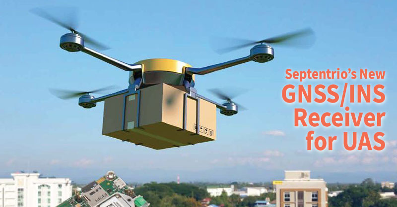
Recently, Septentrio introduced the AsteRx-i S UAS to their product line. This GNSS/INS receiver's design is specifically for Unmanned Aerial Systems (UAS).

AsteRx-i S UAS combines GNSS technology with an industrial-grade inertial sensor. It provides high-accuracy, reliable positioning and 3D orientation (heading, roll, pitch) to aerial drones and other compact robotic systems.

Septentrio’s AsteRx-i S UAS builds on the success of their existing UAV products, AsteRx m2 and m2a UAS.

Designed for UAS

This credit card sized receiver easily integrates into any UAS and is compatible with popular autopilots such as Pixhawk and ArduPilot.

Plus, its light weight and low power consumption optimizes UAV battery life. The result? Longer flight times and improved productivity.  

It is a single-package GNSS/INS product, with an on-board IMU (Inertial Measurement Unit) and standard connectors allowing flexibility of sensor choice.

“Quick receiver integration makes the lives of our customers easier. It also speeds up their system’s time-to-market,” said Danilo Sabbatini, Product Manager at Septentrio.

“Our goal was to combine a high-performance product with a simple and flexible plug-and-play integration design, suitable for any aerial system.” 

Designed to Excel

Septentrio reliable centimeter-level positioning is based on multi-frequency, multi-constellation GNSS technology (GPS, GLONASS, Galileo, BeiDou, QZSS).

AsteRx-i S UAS combines a GNSS receiver with a high-quality IMU to deliver reliable positioning together with 3D orientation.

Septentrio’s unique GNSS – IMU integration algorithm provides continuous positioning during short GNSS outages (coasting) which can happen in flight near high structures, under bridges or during banking turns.

AsteRx-i S UAS comes with built-in industry leading Advanced Interference Mitigation (AIM+) technology.

In aerial drones, where lots of electronics are crammed into a small space, neighboring devices can emit electromagnetic radiation which interferes with GPS and GNSS signals.

AIM+ offers protection against such interference resulting in faster set-up times and robust continuous operation. A built-in power spectrum plot allows users to analyze interference, helping locate its source and mitigating it.

Shop Septentrio's complete line of UAS receivers at Unmanned Systems Source.

About Septentrio

Septentrio provides high-precision, multi-frequency, multi-constellation GPS/GNSS positioning technology for use in demanding applications. Reliable centimeter-level positioning enables machine autonomy and ensures operational continuity, efficiency and safety. Septentrio provides positioning solutions for professional applications in such industries as autonomous vehicles, robotics, construction, mapping, marine, logistics and unmanned aerial vehicles (UAVs).

Tethered Flight with Elistair

Tethered Flight with Elistair

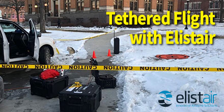
On January 14, 2020, for the first U.S. Democratic debate of the year held in Des Moines, Iowa, CNN deployed an Elistair tethered drone system.

With the support of tether experts, Vector Solutions, Elistair's Ligh-T provided persistent aerial video transmission of the area.

Every four years, the Presidential Candidate debates attracts tens of millions of viewers (69 million on average in 2016). It is the most watched television program in the United States after the Super Bowl.

The live broadcast attracted 7.3 million viewers.

Growing Use of UAVs

The use of UAVs is quickly becoming essential for media organizations who want to offer aerial images to complement ground shots.

One of the many benefits of Elistair Ligh-T tethered station is the unlimited flight time it provides to UAVs. Plus, Ligh-T is compatible with most drones on the market.

Plus, tethered drones do not need to land to change the batteries. As such, a tethered solution allows users to broadcast a continuous stream of aerial images.

Tethered Flight with Elistair

CNN Air flew its DJI M210 tethered to the Ligh-T. The M210 flew at a height of 60 meters for 8 hours on the first day and 5 hours the second day.

The images were instantly fed to the control vehicle and then live transmitted via a 4G link to the production team.

The Ligh-T system offers tremendous flexibility. Because of this, the team moved to different locations throughout the day and continued transmission.

“This solution provides excellent results for any venue that requires constant, uninterrupted over-watch,” said Howe Hildebrand, pilot with Vector Solutions. “It allows for constant, coverage of the subject area. There’s no need to continually land and change batteries, therefore you never lose contact with the subject area.”

How it Works

Thanks to its patented system, Elistair tether stations and modules are compatible with most multirotor UAVs.

Once connected to the micro-tether, the UAV receives continuous power and, as such, has unlimited endurance.

In addition, the tether physically connects the drone to the ground. As such, the drone's light zone is completely secure. Which allows for extremely flexible deployments in difficult environments. This is particularly useful in urban areas with a high density of infrastructure and population.

Shop Elistair's complete line of tether solutions at Unmanned Systems Source.

About Elistair

Created in 2014, Elistair specializes in the construction of tethered UAVs for defense, civil security, security companies and major industrial accounts. The systems developed by Elistair allows to quickly and simply secure a sensitive area, event or site, by offering a global and secure aerial view, continuously.

Choosing an RF Filter Type

Choosing an RF Filter Type

Choosing an RF Filter Type for your application could be crucial to the system's performance. But why is RF filtering so important?

Filters reduce the interference in the environment that affects the performance of the communication system. Plus, filters also reduce the interference caused by the communication system.

Once you have identified the system level need for a filter, it’s now time to determine which filter response type will accommodate your other system level requirements.

At NuWaves, the most commonly utilized response types are the Chebyshev, Bessel-Thomson and Butterworth.

The first step is to thoroughly review a customers' specifications and requirements. After this, the team can choose the proper filter.

Below is a quick overview of these filter response types and their implications on the overall system performance.

Chebyshev

The most common filter response used to fill customer requirements is the Chebyshev filter.

It is the right choice for applications the require high out-of-band rejections. It is also great for those that require stop-band rejections close in to the passband corner.

This response type provides for steeper roll-off (attenuation) to stop-band frequencies. The draw back is that it can create large variation in group delay flatness.

Bessel-Thomson

Another filter type is the Bessel-Thomson filter.

This filter type provides for the maximum group and phase delay flatness, allowing the filter to preserve the input waveform shape.

For a given percentage bandwidth and order, this type provides for the lowest attenuation in the stop-band.

The drawback to the Bessel-Thomson filter type is that is does not preserve amplitude flatness.

Butterworth

The Butterworth response type is another common approach to ensure that the filter will integrate properly into the higher-level system requirements.

This filter type, when compared to Chebyshev, provides for better group delay flatness, overshoot, and lower (or absent) passband ripple.

The drawback to a Butterworth filter is that it has a much slower roll-off to the stop-band. And, it can require a higher order filter to achieve a desired attenuation at the stop-band frequency.

Choosing an RF Filter Type

Selecting the correct filter type is important to the overall system performance.

Understanding the impacts to the overall system requirements -- including the requirements of a given waveform -- are important. Choosing the right filter response type will result in higher integration success.

If your UAS communication system is not meeting the expected performance, consider adding filters to your design.

Filters are easy additions to the system: filters can be small and lightweight, do not require electrical power to function, and are generally low-cost items. Filtering can make a significant difference in the performance of your UAS.

About NuWaves

NuWaves Engineering developed a wide variety of off-the-shelf RF amplifiers with rich features to support mission-critical CONOPS in telemetry, ISR, and tactical communication systems applications. Frequency ranges are available from UHF through C-band with output power levels ranging from 5 to 50 W.

All NuPower PAs are designed, built, and tested in-house under NuWaves’ Quality Management System (QMS) certified to AS9100:2016 and ISO 9001-2015 standards, which ensures that each product arrives on-time and defect-free. Most models are in-stock.

Learn more about NuWaves' product line at Unmanned Systems Source.

FT205 Sensor Helps Map Urban Canyons

FT205 Sensor Helps Map Urban Canyons

Urban Air Mobility (UAM) represents a new era in air transportation.

The goal of UAM is to develop a safe and efficient air transportation system. Within this system, everything from small package delivery drones to passenger-carrying air taxis safely and efficiently operate over towns and cities.

However, before UAM is declared fully viable in populated areas, government, industry and academic partners are researching its practicalities.

Urban Canyons

Drones are currently in use in relatively underpopulated rural areas. However, cities are an entirely different matter.

One of the challenges? Cities have very different terrains. Building lined streets create “urban canyons”. The effect of these ‘urban canyons’ on drone operations is not yet fully understood.

For example, a breeze funneled into the relatively narrow gap between buildings, can dramatically increase wind speed. As well, the heat from city surface temperatures can produce unexpected thermals.

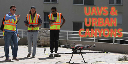
To study such urban canyon effects, a team from Embry-Riddle Aeronautical University and Gaetz Aerospace Institute took off to Kosovo.

Acquiring permission to fly in a densely populated area in the United States was going to be a challenge. So the team identified Kosovo as an alternative.

The Test

The team flew the DJI S1000, an eight-motor ‘octocopter’ drone, in two cities – Janjeva and Prishtina.

They rigged the drone with special instrumentation including two FT205 sensors. The team mounted the sensors orthogonally to measure both horizontal and vertical wind fluctuations.

Temperature, humidity and air pressure were also measured.

The team – combining wind speed, direction and temperature information gained from the anemometers along with aerial photos captured by the drone – generated 3D models showing 3D wind components.

The Results

With the help of the FT205 sensors, the team measured the wind turbulence in an urban canopy. This information is hugely helpful to companies looking into urban air mobility.

This data improves understanding of an aircrafts flight environment in urban areas.  

“Within the atmospheric ‘boundary layer’ in cities, the wind constantly shifts as it flows over hot asphalt, followed by cooler green spaces, water-filled canals, and structures of various shapes and sizes,” said Dr. Kevin Adkins, Associate Professor of Aeronautical Science at Embry-Riddle Aeronautical University. “To map those unseen changes, researchers have traditionally simulated urban environments in wind tunnels or with computer models. For the first time, Embry-Riddle faculty and students have captured real-world data to create a three-dimensional map of drone routes.”

Covers new ground

“Nobody else has been studying the urban atmospheric boundary layer in this particular way,” said Adkins. “Many companies are now working on drone-based package delivery, infrastructure inspection and urban air mobility. We need a better understanding of airflows and microclimates in cities so that these new technologies can operate as safely as possible.”

Find out more about the study.

“We were able to make multiple urban boundary layer measurements, right smack downtown in Prishtina, in an urban canyon with 14-story buildings on either side.”

“The FT205 wind sensors were perfect for our operations. Their light weight and accurate measurement contributed immensely to the success of the project. The sensors have been on the road, traveled halfway round the world and back again, and have stood up well!”

Shop FT Technologies line of drone and pole mounted sensors at Unmanned Systems Source.