11May
Phase One announces full integration of aerial cameras with DJI’s M600 and M600 Pro
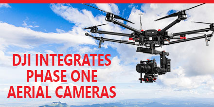 Phase One Industrial recently announced the full integration of its iXU and iXU-RS aerial cameras with DJI’s M600 and M600 Pro drones. Built using DJI’s SDK, this is just the latest drone platform supported by Phase One Industrial.
Phase One was the first to deliver 100-megapixel medium format aerial cameras. Since then, Phase One has continued to innovate inspection tools uniquely capable of addressing diverse aerial imaging applications. Those applications range from photogrammetry to critical infrastructure to monitoring projects.
High quality solution for aerial imaging applications
The aerial cameras’ integration with DJI’s M600 and M600 Pro platforms is delivering high quality solutions for aerial imaging applications. “Using the Phase One Industrial IXU camera with the new Integration package for our DJI M600 drone, the results were extraordinary,” said UAV Flight Systems Manager Tobias Wentzler, Lufthansa Aerial Services. “We achieved millimeter per pixel accuracy, allowing us to inspect the required objects in exquisite detail and lift our mission results and accuracy to a new, high-end level, identifying the subtlest cracks or imperfections that were not visible to conventional inspection methods.” Phase One continues to develop aerial imaging solutions that meet the exacting needs of aerial imaging professionals. “When our clients hire us, they expect the best,” said Ron Chapple, CEO of Aerial Filmworks. “With the new Phase One Industrial aerial cameras integrated with DJI drones, Aerial Filmworks delivers robust performance, highest resolution and finest image quality to support our clients’ cinematic projects. “GEO1, the survey division of Aerial Filmworks, a solutions-driven provider in the electric and gas/oil marketplace, also benefits from this development. Now, we have the right solution to help satisfy our clients’ requirements for the high-resolution data and flight efficiencies.”Capabilities include
Phase One Industrial iXU and iXU-RS aerial cameras’ integration with DJI M600 and M600 Pro drone systems include:- 100MP and 50MP metric aerial cameras
- Smart triggering of the camera by waypoints / fixed distance / fixed time
- Support for mission planning applications (such as DJI Ground Station pro) – for waypoints missions
- Geo-tagging of all files’ location and gimbal position
- Dual remote controllers (drone and camera) enable each operator (UAV pilot and camera operator) to focus on their respective mission goals
- Industrial-grade build of the camera and aerial lenses for use in harsh environments
Phase One DJI Integration
Designed using the DJI open platform development tools, iX Capture Mobile offers various operating modes, including:- Video Streaming
- Auto or Manual Capture settings to determine the values of the ISO, shutter speed and aperture
- Auto capture mode to enable image capturing by waypoints, fix distance or by time intervals
- Camera control via DJI Lightbridge 2 dials

 May 9, 2017 – Unmanned Systems Source is looking forward to connecting with clients, vendors and friends May 8-11 at the XPONENTIAL show in Dallas, TX.
Unmanned Systems Source provides users a single source of supply and information for unmanned and remote sensing applications.
“We are often referred to as the ‘Amazon’ of the Unmanned world,” said Jennifer Jerrick, CEO of Unmanned Systems Source. “Prosumers, developers, manufacturers, and procurement agents, alike, can find what they need to outfit their unmanned projects. We are a one-stop-shop.”
Unmanned Systems Source, though, is more than just an e-commerce site.
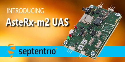 May 8, 2017 - Septentrio, a leading manufacturer of accurate and reliable GNSS solutions, announced the release of the AsteRx-m2 and AsteRx-m2 UAS OEM boards.
These OEM boards bring the latest in GNSS positioning to the market with unmatched interference mitigation technology all on ultra-low-power.
Septentrio will showcase these OEM boards in Dallas, Texas at AUVSI's Xponential 2017.
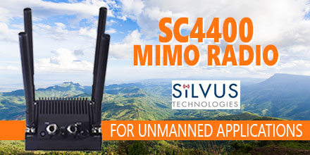 Silvus Technologies is preparing to showcase its new StreamCaster 4400 radio at the upcoming AUVSI XPONENTIAL show in Dallas, TX.
The SC4400 is a 4×4 MIMO radio designed for unmanned systems applications. It transmits high-definition video, data and communications at near zero latency over long distances.
Also, it can deploy as a point-to-point data link or as part of a comprehensive, self forming/self healing mesh network. And it intelligently optimizes signal transmission in both line-of-sight and non-line-of-sight operations.
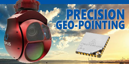 Octopus ISR Systems, a division of UAV Factory Ltd., announced the release of a new feature, "Precision Geo-Lock", for its miniature Epsilon series of gyro-stabilized gimbals.
Precision Geo-Lock combines a state-of-the-art GPS-aided inertial navigation system (GPS/INS) with dedicated software algorithms and payload operator software. It provides the user with highly accurate target geo-location, range-to-target, as well as Geo-Lock functionality and moving map user interface.
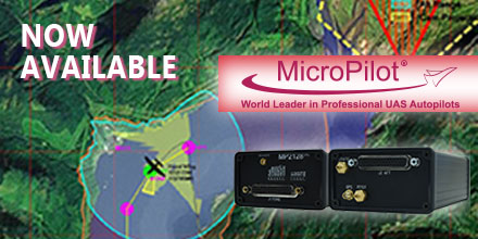 April 4, 2017 – Unmanned Systems Source is pleased to announce a new distribution partnership with MicroPilot, producers of full-featured UAV autopilots.
“MicroPilot is a world leader in small autopilot systems for UAS,” said Drew Osbrink, Business Development Director for Unmanned Systems Source.
"The MicroPilot product line is a great fit for customers looking for a reliable solution to manage complex autonomous behaviors for their UAS platforms,” said Osbrink.
Introduced in 2004 and weighing only 28 grams, MicroPilot's MP2x28g2 raised the bar around the world for functionality and value in small UAV autopilots. Paired with this full-feature UAV autopilot, the MicroPilot HORIZONmp ground control software provides a user-friendly, point-and-click interface for mission planning, parameter adjustment, flight monitoring, and mission simulation.
Building on the success of these proven innovations, MicroPilot now offers a series of autopilots, software, accessories, and customized UAV training and integration services.
