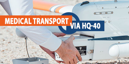
Researchers from John Hopkins University School of Medicine recently partnered with Latitude Engineering for a very unique study. The goal? To test the viability of transporting medical samples across 161 miles of Arizona desert via drone.
LatitudeEngineering's HQ-40 provided transport. The on-board payload system maintained temperature control throughout the three-hour long flight. This ensured the samples maintained viability for laboratory analysis upon landing.
The successful mission also set a new distance record for unmanned medical drone delivery.
Advanced report findings
A report, published ahead of print in the American Journal of Clinical Pathology, June edition, gave light to some interesting finding.
Accumulative evidence, investigators suggest, indicates that unmanned aircraft are an effective, safe and timely way to quickly transport medical samples from remote patients to laboratories with advanced diagnostic capabilities.
“Drone air transport will be the quickest, safest and most efficient option to deliver biological samples to a laboratory whether it be in a rural or urban setting,” says Timothy Amukele, M.D., Ph.D. “We don’t need to fix 20th Century problems, such as no roads, poor roads or driving vehicles through crowded urban streets to improve patient care. Logistical inefficiencies are an enemy of patient care. Drones will take patient care into the 21st Century by making patient diagnoses quicker and more efficient.”
Real world results
The study demonstrated real world long distance transport of samples involving several modes of transportation. The team collected 84 samples in pairs at the University of Arizona in Tucson and driven 76 miles to an airfield. One sample from each pair was loaded on the drone, which flew them 161 miles.
Following the flight, they transported all sample 62 miles to the Mayo Clinic in Scottsdale, Arizona. Finally, the team compared each pair of samples was to check for differences between the flown and not-flown sample.
Results from sample pairs were similar for 17 of the 19 tests. Small differences were seen in Glucose and Potassium, which do also vary in other transport methods. We suspect the differences seen in this test arose because the samples not-flown by drone were not as carefully temperature controlled as the flown samples in the temperature-controlled chamber.
Medical transport via drone
The aircraft used in this study was a Latitude Engineering HQ-40. The unique "quadplane" hybrid configuration of the craft enables it to take off vertically and transition to traditional horizontal flight. Due to its unique design, the HQ-40 can land in small spaces as well as fly efficiently between widely separated facility. This makes it a viable option for use at medical facilities.
The flight team took numerous precautions throughout the test. A certified remote pilot controlled the aircraft throughout the test which they performed in restricted airspace at a military aircraft test range cleared of all traffic. The flight team controlled the aircraft via a radio link between the on-board flight computer and the ground control station.
The team packed and transported the samples according to IATA guidelines.
During transport, the samples were in a temperature controlled chamber designed by the Hopkins team. The chamber used electrical power from the aircraft to maintain the samples at room temperature. The device is lighter than an equivalent amount of ice, the current method of temperature control. Additionally, the chamber can warm the samples in cold weather.
Building on previous work
Previously, the Johns Hopkins team studied the impact of drone transportation on the chemical, hematological, and microbial makeup of drone-flown blood samples. They found no negative affects on the samples. The test involved drone flight distances up to approximately 20 miles.
The new study examined the effects of drone transportation over longer distances, more than 160 miles, and significantly longer time periods that require environmental controls. The team plans further and larger studies in the U.S. and overseas.
“My vision is that we engage drone technology to fly over challenges presented by self-limiting ground transportation systems,” says Amukele. “So, our hospitals will have diagnostic results far more quickly. And, when a first responder arrives to the scene of an accident, he or she will be met by a medical delivery drone carrying the correct blood product. Together, we will most certainly improve care and save more lives.”
Authors of this study are include Timothy K. Amukele MD PhD, and Jeff Street, Department of Pathology, Johns Hopkins University School of Medicine. Christine LH Snozek PhD and James Hernandez MD, Department of Laboratory Medicine and Pathology, Mayo Clinic College of Medicine, Mayo Clinic in Arizona, Phoenix and Scottsdale, Arizona. Ryan G. Wyatt, Matthew Douglas MD, and Richard Amini MD, Department of Emergency Medicine, University of Arizona, Tucson, Arizona.
Peter Kovler of the Blum-Kovler Foundation provided funding for the study.
Find out more about the Johns Hopkins study,
here.
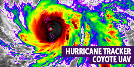 The scientific community continues its quest to better understand hurricane behavior.
Recently, The National Oceanic and Atmospheric Administration (NOAA) deployed six Raytheon Coyote UAVs to track and model Hurricane Maria.
The Coyotes flew directly into the storm and provided researchers an unprecedented view of the hurricane. The UAVs launched from a NOAA WP-3D Orion – fondly dubbed the “hurricane hunter”.
The Coyote operated in the lower part of the hurricane, an area impossible for manned aircraft to reach.

 Researchers from John Hopkins University School of Medicine recently partnered with Latitude Engineering for a very unique study. The goal? To test the viability of transporting medical samples across 161 miles of Arizona desert via drone.
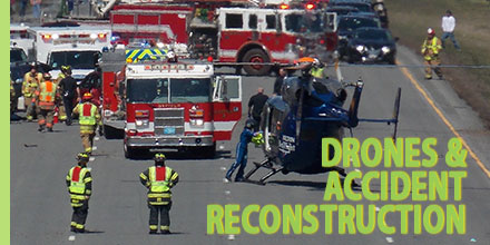 Documenting, investigating and reconstructing accident scenes is time consuming. And, depending on the site, it can also pose risks for reconstruction specialists.
The work, though, is vital.
The data gathered from reconstructing an accident helps officials identify what went wrong. It also informs future decisions to improve overall traffic safety.
The pressure to clear the roads as quickly as possible following an incident, is enormous. However, documenting the accident is vital…and some can stretch over a considerable area. Photographing, measuring and capturing all the details using traditional methods takes considerable time and energy.
So, it should come as no surprise that some public safety departments are testing the feasibility of drone use for reconstruction efforts.
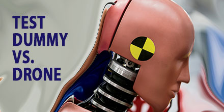 The push to create the infrastructure to support drone delivery on a massive scale continues. Of course, there are numerous challenges to identify and overcome before this is reality. One such dilemma involves the safety of people on the ground.
Enthusiasts envision a day when drones populate the skies delivering packages, conducting public safety operations and much more. However, before this occurs, there is a need to address the safety of those on the ground.
Currently, the FAA does not allow for unmanned aerial operations to occur over people. Clearly, this must change if drone use is to become part of everyday life.
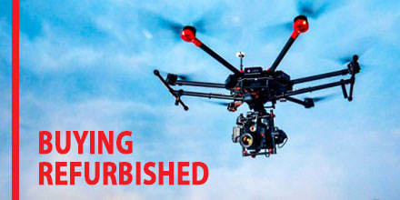 Smart phones, game consoles, smart TVs...and now, drones.
New technology is exciting but the cost of owning the latest gadgets prevent many from immediately running out and buying it. Many wait months before purchasing coveted products in the hopes that competition may eventually drive the price down.
However, some savvy shoppers choose another path...refurbished products.
From smartphones games consoles, refurbished electronics are a viable option for price-conscious consumers. Refurbished products offer consumers the chance to buy updated technology at a reduced price. However, when considering refurbished gadgets, a little due diligence is required.
 That didn’t take long.
DJI, the Chinese-based company, took little time to address the gathering noise over cyber security concerns.
At the beginning of August, the U.S. Army called for troops to cease and desist use of DJI drones, equipment and cameras for any operations.
The Army's announcement seemed to catch DJI unaware.
In the last few days, DJI announced that it will accelerate the release of a new feature, Local Data Mode. This feature will be a part of the DJI controller app. When selected, Local Data Mode will allow pilots to disconnect from the internet during flights.
The update releases at the end of September.
“We are creating Local Data Mode to address the needs of our enterprise customers, including public and private organizations that are using DJI technology to perform sensitive operations around the world,” said Brendan Schulman, DJI Vice President of Policy and Legal Affairs. “DJI is committed to protecting the privacy of its customers’ photos, videos and flight logs. Local Data Mode will provide added assurances for customers with heightened data security needs.”
This feature is designed to stop internet traffic to and from DJI’s flight control application. This would make it “impossible” for the craft to communicate any flight log data, photos or videos with DJI servers. It would also prevent any accidental syncing with DJI servers.
DJI believes Local Data Mode offers users some level of data management. DJI hopes this feature will help alleviate privacy and security concerns for sensitive operations.
