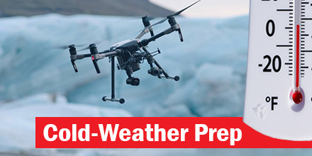
Flying drones in cold weather is not an issue for many operators. After all, there is not much that keeps them from flying, even extremely cold weather.
Besides rain and high winds, a drop in temperature is usually not enough to keep a pilot grounded.
Today, a majority of multi-rotors can withstand temperatures ranging from 32-145 degrees Fahrenheit. For specific thresholds, check the user manual which came with the drone. However, drone operations in cold-weather do require adequate preparation.
Tip #1: Avoid Ice Build-Up
Of course, there are a variety of cold-weather conditions that could endanger a drone's function. However, ice is one of the biggest issues an operator needs to guard against. At all costs, avoid any ice build-up on the device.
If a drone’s wings or propellers become covered by ice, it can alter its load distribution and thereby affect its aerodynamics.
Condensation is of particular concern. In cold-weather flights, freezing air flows over the warm body of the drone which can form into condensation. It can then settle and freeze on the surface of the drone affecting the UAVs flight performance. Furthermore, when the ice melts it can cause further damage by seeping into the drone’s internal electronics.
Tip #2: Keep an Eye Out for Rain
Unless a pilot is aware and confident in the drones overall
IP-rating, it is simply good practice to avoid flying in rainy conditions.
Obviously, drones are machines made up of various electrical components. As such, these components are affected by moisture just like any other electronic. Water can seriously damage motors, camera’s and other parts.
If caught in rain or snow, cease operations immediately and remove any water by wiping down the drone.
Tip #3: Remember the Batteries
Cold weather impacts batteries differently than warm weather. As such, batteries need to be adjusted accordingly.
In cold weather, the chemical response within the battery slows. This results in the reduction of flight time. Depending on the temperature, flight time can reduce by up to 20%. Extreme drops in temperature can also result in a sudden reduction in power. In some instances, extreme temperatures can result in complete battery failure.
Best practices for cold-weather battery care include:
- Fully charge all batteries
- Pack spare batteries
- Store batteries in a warm place
- Hover on the spot after take-off
- Take it easy on the throttle when flying
- Take a portable charger
To get longer life and flying time out of your batteries always ensure they are fully charged in preparation. These and any spares should be stored somewhere warm such as a suitable carrier during transit to avoid degradation.
A sensible idea is to hover "on the spot" for a few seconds after takeoff. This allows the battery to warm up prior to full flight.
Finally, be sure to also take it easy on the throttle during flight and consider bringing in the drone to land once you have less than 30% of power left as a precaution. This is where having spare batteries or a portable charger come in and it helps to guard against any sudden loss of power midair.
Tip #4: Altitude and Local Weather
Another consideration is altitude. Flying in high altitudes means the propellers must spin faster to compensate for thinner air. As such, the batteries drain more quickly which means shorter flight times.
Local weather can also greatly impact the length of drone flight. Areas described as ‘dry’ versus areas with more humidity in their air certainly affect a drones performance.
Ground conditions are another factor. For example, puddles of water of packs of snow can damage a landing drone. In such conditions, weighted sheets can provide a dry surface on which to land - thereby minimizing contact with any moisture.
Tip #5: Don't forget the pilot
Last but not least, it’s a good idea to look after the pilot, as well.
Essential supplies, such as: gloves, goggles, scarves, layers of warm clothes, and hot drinks can keep pilots safe in the elements. Packing extra cloths to wipe down the drone after operations, is also helpful.
Flying drones in cold weather is possible. Simply keep in mind the tips above to ensure a safe, efficient flight...despite the temperature.
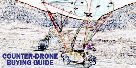
 Department of Homeland Security's SAVER program recently identified 13 counter-unmanned aerial systems that could be useful for emergency response.
To accompany this announcement DHS also issued a guide on their features to assist procurement.
National Urban Security Technology Laboratory (NUSTL) SAVER program conducted the market survey of counter-unmanned aerial systems to help emergency responders identify useful products.
The SAVER program is designed to help emergency responders make procurement decisions. SAVER conducts operationally orientated assessments of equipment and then releases the information.
Responders use that information to select, procure, use and maintain the equipment.
Its Counter-Unmanned Aerial Systems (C-UAS) Market Survey identified 13 such products and weighed their benefits and suitability for specific purposes.

 What lies between the Pacific coasts of Japan and Silicon Valley?
About 4,500 miles of ocean, of course! A distance easily traveled by commercial airlines but certainly beyond the reach of non-military drones.
But is that about to change?
Yes. If, that is, a winner emerges from the
  The past decade witnessed the explosion of drone technology and the widespread adoption of this technology for numerous applications.
The use of UAVs is varied — from construction and agriculture to videography and real estate — and applications continue to expand.
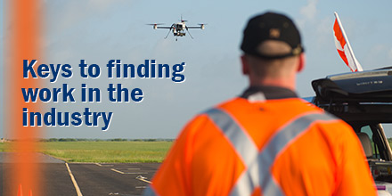
This burgeoning industry has left many wondering if a passion for flight could evolve into an exciting career.
However, the path to becoming a professional drone pilot takes diligence and planning. So, for an experienced drone pilot, how easy is it to set up business and watch the money roll in?
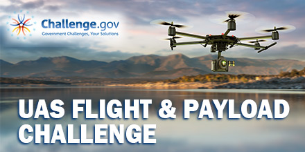
 The National Institute of Standards and Technology (NIST) recently issued a Unmanned Aerial Systems (UAS) competition.
The challenge? Design and build a cost-effective drone that carries the biggest payload and stays airborne the longest. The top ten designs in the Unmanned Aerial Systems Flight and Payload Challenge compete for prize awards totaling $432,000.
Hosted by NIST Public Safety Communications Research Program, the challenge consists of three stages. Stage 1, concept paper submission, closes January 29, 2018 at 3pm ET.
In addition, finalists will showcase the UAS with paid travel to the NIST Robotics Lab and the 2018 PSCR Stakeholder conference.
Results from the UAS Flight and Payload Challenge support the public safety community and its stakeholders.
 2017 brought some of the most powerful storms of the decade, resulting in over $188 billion in damages.
Just three major storms of the Atlantic hurricane season — Harvey, Irma and Maria — ran up the majority of the damages.
Manned aircraft, though incredibly helpful, are often too large and heavy to land in areas affected by these storms. As such, many aid and relief organizations are looking for unorthodox solutions. Enter drones.
 Flying drones in cold weather is not an issue for many operators. After all, there is not much that keeps them from flying, even extremely cold weather.
Besides rain and high winds, a drop in temperature is usually not enough to keep a pilot grounded.
Today, a majority of multi-rotors can withstand temperatures ranging from 32-145 degrees Fahrenheit. For specific thresholds, check the user manual which came with the drone. However, drone operations in cold-weather do require adequate preparation.
