Industry News

Apple May Harness Drone Technology To Improve Apple Maps Accuracy

Apple has supposedly begun work on a drone-powered alternative to keep their Apple Maps service up to date and faster that their current fleet of sensor and camera-outfitted vans and vehicles. According to a report by Bloomberg Technology, Apple intends to use drones to examine street signs and track changes to streets and roads. Additionally, the report indicates that monitoring construction projects is also a major goal of the project, which has not yet been fully approved by the FAA. While Apple usually does not respond to inquiries regarding future plans and technologies they will be using, there was an FAA exemption granted on March 22, 2016 for Apple to "operate an unmanned aircraft system to conduct data collection, photography, and videography". In the application, Apple stated they would be using many different drones from DJI, Intel, and Parrot, with data collection services managed by a company called Aibotix GmbH. In the application, Apple also addressed potential safety hazards of using the drones and how they intend to mitigate the risk:
The proposed operations do not create any hazard to users of the NAS or pose a threat to national security. The Aircraft are battery operated with a maximum flight time of less than 25 minutes. The Aircraft weigh less than 55 pounds. The Aircraft will be operated at or below 400 feet AGL within the visual line of sight of the pilot in command. UAS operations will be over private or controlled access property with the permission of the owner/controller or authorized agent.
You can read the full FAA exemption filed by Apple here. If Apple begins mapping efforts as intended, they may face some obstacles considering that current FAA exemptions still do not allow you to fly over people or roads. How Apple intends to navigate around these restrictions is still up in the air (no pun intended). Digital maps are essential to both the Apple and Google ecosystems, with consumers and developers alike both relying on the accuracy of the maps to travel to and from locations, and develop applications that use the map features. Accuracy is key, and if Apple can improve its current mapping efforts to match or beat Google, they will be well positioned for growth and user adoption.

UK Releases Revised Set of Drone Operation Rules Ahead of Holiday Season

The United Kingdom has released a simplified set of guidelines regarding drone operations in preparation for a holiday season that is expected to bring thousands of new drones into the homes of consumers. In an effort to make it easier for drone owners to remember the guidelines, the Civil Aviation Authority (CAA) has released the following mnemonic to make it easy to remember the rules:

  • Don't fly near airports or airfields
  • Remember to stay below 400ft (120m) and at least 150ft (50m) away from buildings and people
  • Observe your drone at all times
  • Never fly near aircraft
  • Enjoy responsibly

The CAA is responsible for the UK's airspace and aviation operations, and although they do have a full explanation of drone operator rules, it seems fitting that they would try and simplify the rules for first time drone buyers who may not be aware of the regulations after purchasing, or receiving a drone as a gift.

In a CAA press statement, Andrew Sage, an air traffic control provider at the NATS, said:

Drones are an incredible, inspiring technology but it's vital that people are using them safely.  With the number of reported drone incidents on the rise, it's important that people understand their legal obligations and fly safe, having fun whilst ensuring other users of the UK's airspace aren't put at risk.

Through research, the CAA found that the UK public had concerns regarding drone use, so hopefully the simplifications done to the drone code will ensure that even first time drone operators know the basics of how to safely fly their drones in UK airspace.

Looking To Purchase A Drone? Check Out These Great Options

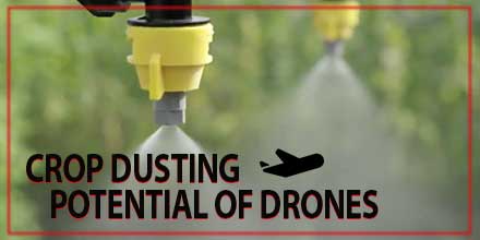
Crop Dusting Potential of Drones

crop_dusting_dronesDrones, though more common today, have  disrupted the way various industries choose to conduct business. From film-making to surveying and photogrammetry, drones help make processes easier, faster and more affordable. Today, designers and manufacturers of unmanned aerial vehicles are turning their attention to the farm industry. One area of interest is the potential of crop dusting drones. And with drones featured heavily at agricultural shows, farmers are increasingly aware of their potential.  

Industry takes notice

A number of UAV companies – manufacturers and businesses alike – have made inroads into the crop dusting industry. Drone manufacturer DJI recently released the DJI Agras MG-1. Designed specifically for agriculture, it features eight rotors powerful enough to lift over 22 pounds of spraying liquid. Integrated Precision Agriculture, out of Galesburg, Illinois, is currently conducting spraying tests with local farmers. IPA hopes to begin commercial operations early next year once its license is approved. Currently IPA is using two drones – a DJI Inspire for land surveying and a larger vehicle for spraying crops. The company reports that enthusiasm for its surveying and spraying services from farmers is high. The use of drones to spray crops on large farms is similar to the traditional methods widely used today. However, drone technology does offer many useful advantages in crop dusting. To begin, drones can survey crops and gather data on large tracts of land affordably and relatively quickly. Furthermore, with the ability to map the drone's flight path, UAVs are actually a more efficient method of crop dusting.  

Environmental factors

Another crucial benefit is the reduction of chemical drift. Traditional crop dusting planes fly at higher altitudes. This greater height allows some of the pesticide to drift into neighboring fields and environments. Drones, in contrast, offer more targeted dusting. Drone can fly much closer to crops which, in turn, can reduce chemical drift. Plus, drones are battery powered which adds to its environmental credentials. As advances continue, the full potential of crop dusting drones is just a matter of time. What farmer's choose to do with this emerging technology is still in question. Early adopters may simply hire commercial companies such as IPA to replace traditional methods. Other farmers may choose to invest in the technology and conduct their own spraying flights - gaining full control over both projects and expenditures. It is clear that drones have a lot of potential in the crop dusting industry. The many benefits they afford both farmers and the environment makes them an excellent fit for the task at hand.

Southwest Antennas Releases World’s Smallest Circularly Polarized Cloverleaf Omni Antennas

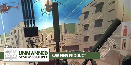
SWAIdeal for HD video and high speed data transmission and reception from mobile platforms and offers great improvements to spatial diversity and spatial streaming in MIMO radio systems. Southwest Antennas is pleased to introduce its new small form factor “Turbo Cloverleaf” family of circularly polarized (CP) Omni antennas in 1.98 - 2.2 GHz and 2.3 - 2.5 GHz frequencies. These new and innovative antenna products deliver substantial increases in high data rate throughput and signal-to-noise ratio (SNR) in a very compact, rugged radome that measures less than two inches on any side. Each antenna in the new family of products also features an integrated 3” RF coaxial gooseneck assembly with ruggedized non-rotating RF connector options that allows for flexible antenna mounting and positioning with other closely located equipment or co-located antennas. The new Turbo Cloverleaf antennas were designed with radio users in mind who are in need of the performance that only a Cloverleaf style CP Omni antenna can offer, but in a new compact form factor. The resulting design delivers the world’s smallest cloverleaf style antenna offering robust performance with modern radio systems that are increasingly seeing operation in the wireless broadcast TV / wireless video and live sports markets, UAV / drone video systems, vehicle-mounted radios, and tactical law enforcement and military radios that are utilizing MIMO/MANET system architectures for improved video, voice, and data transmission. “Typical L/S licensed band and 2.4GHz ISM band Cloverleaf antennas currently available on the market have many inherent design flaws that make them ineffective at best for unmanned systems applications and applications requiring two or more co-located antennas” said Benjamin Culver, President, Southwest Antennas. The design and size of this new product line makes it a great options for various applications. “First, the Cloverleaf antennas currently available on the market do not typically have a ruggedized Radome or any Radome at all and they just use exposed wiring to create the antenna cloverleaf radiating element structure that is covered with plastisol or similar insulated coating, leaving the antenna easily susceptible to damage. Second, these antennas measure well over 6” in outside diameter making them impractical for installation on a UAV or drone platform. Third, they have poor and improper impedance matching at the antenna feed point and finally they have poor radiation pattern control over frequency due to inadequate RF choking on the antenna’s cable feed. “The new Southwest Antennas Turbo Cloverleaf antenna design solves all of these challenging design problems by the implementation of the proprietary new Southwest Antennas design approach which reduces the size of the cloverleaf antenna drastically by over 3X in outside diameter without adversely affecting antenna gain or efficiency. The new design uses SMT components inside the Radome located on the antenna element to tune the antenna performance perfectly right at the antenna feedpoint which is a critical factor in the design of high performance cloverleaf antennas. Other proprietary design techniques are used to maintain excellent radiation pattern control over the entire operational frequency band. In short, Southwest Antennas has solved some huge antenna industry problems with the new Turbo Cloverleaf design and we expect this new design to receive industry wide adoption in a large number of diverse applications where status quo Cloverleaf antenna products will just not meet the system requirements”. The proprietary Southwest Antennas Turbo Cloverleaf antenna designs offer over 40dB of isolation between two co-located antennas with opposite CP polarizations which is a significant improvement over two co-located vertical or opposite slant polarized antennas. This new design has shown over 50% improvement in data rate throughputs and over 30% improvements in SNR. These exciting new antenna products are now available for immediate purchase in both Right Hand and Left Hand circular polarizations. Shop now!   About Southwest Antennas Southwest Antennas specializes in the design and manufacture of rugged, high-performance RF and Microwave antennas, accessory products, and customized antenna solutions built for today’s demanding communication environments. Founded in 2005 and headquartered in San Diego, California, Southwest Antennas offers over 1,000 standard products for broadcast video, military / defense, law enforcement, homeland security, surveillance, aerospace, oil and gas, and M2M markets.

Unmanned Systems to the Rescue

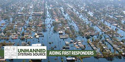
Disasters_TUnmanned advancements help first responder's efforts When disaster strikes we look to the men and women in emergency services to render aid to those affected. Thanks to advances in technology, first responders now have unmanned systems to help in those efforts. Currently, unmanned helpers include Unmanned Aerial Vehicles and robots equipped with sensors, cameras, and even microphones.  

Unmanned Systems impact on an industry

The impact of unmanned technologies in emergency and disaster situations continues to grow. Drones offer numerous advantages including: rapid deployment, the ability to assess dangerous environments from a safe distance, minimize risk to workers, and more. Operators can change drone equipment to adjust to changes in the environment. A night-vision camera can be quickly exchanged for an infrared camera to read heat signatures of survivors. Programmable flight paths ensure complete coverage of an area. All these advantages can significantly impact the number of lives saved in the event of a disaster.  

Extending relief workers’ reach

UAVs are particularly helpful in reaching areas that are inaccessible. Drones equipped with high resolution imagers can provide pictures, stream live video and create before and after snap shots of the affected site. Emergency workers can use this information to determine a plan of action – where to deploy, areas to avoid, identify survivors, and more. What's more, drones can re-deploy to get the most accurate data in what is usually a very active and changing situation. Officials can use the data to continuously adjust and respond accordingly. First responders aren’t the only ones who benefit from drone use in emergency situations. Drone manufacturers can use feedback from operators in the field to improve the overall performance of the product, thus improving capabilities for future relief efforts.  

The challenge of the amateur operator

Unfortunately, the growing use of drones also has a downside. As more enthusiasts take to the skies, they can pose a risk to active emergency situations. Many well-intended users believe they are providing assistance when, in fact, their efforts can hamper and even derail relief efforts. Such situations require formal training, expertise and collaboration with disaster and emergency relief officials. Operators functioning on their own volition are a risk to personnel on the ground. Rescue organizations continue to advise drone enthusiasts, not officially involved in efforts, to restrain themselves and stay away from active emergency situations.  

A growing array of unmanned systems

Rescue personnel can choose from an ever increasing array of unmanned systems. For example, RoboSimian is a highly dexterous robot that can access areas deemed too risky for humans. This robot can scan, assess as well as manipulate its environment. Currently, RoboSimian can close a valve, pick up an object and remove impediments. Certain situations require even more sophisticated technology – such as detecting movement under piles of debris. Developed by NASA’s Jet Propulsion Laboratory, FINDER (Finding Individuals for Disaster and Emergency Response) utilizes low power radar to detect imperceptible movements beneath rubble. FINDER’s radar emits a low power radio signal that bounces off debris and changes if movement is detected. As with robots and UAVs, FINDER is an important tool that enables rescuers to locate those in need and provide assistance quickly and efficiently.  

A bright future

Given the advantages unmanned systems offer, emergency and disaster relief agencies will continue to adopt this technology. For the agencies involved in planning and executing search and rescue operations, the deployment of UAVs, robots and additional technology is a positive development.

Wildfire Operations & Temporary Flight Restrictions

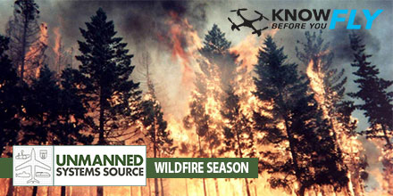
wildfire_T"Know Before You Fly" Urges Operators to Stay Away from Wildfires, Adhere to Temporary Flight Restrictions 

WASHINGTON — The Know Before You Fly campaign today urged operators of unmanned aircraft systems (UAS) to respect temporary flight restrictions (TFRs) over and around wildfires as this year’s wildfire season makes an early start.

Wildfires or other hazardous conditions often lead to authorities putting in place TFRs, which allow first responders to do their jobs unimpeded and without danger to their aerial support.

Temporary Flight Restrictions

Violating the TFR may endanger the safety of the operation, and in some cases may ground search and rescue crews until the airspace is cleared, allowing the wildfire to spread. But TFRS do not just apply to wildfires.

For stadium events ranging from concerts to NASCAR races to the Super Bowl, model aircraft flights and unmanned aircraft operations are generally restricted. More information about the types of TFRs may be found here.

To check for TFRs in your area, visit the FAA TFR list at http://tfr.faa.gov/tfr2/list.html. Additionally, download the FAA’s B4UFLY app, available on the App Store or Google Play, to find up-to-date information on TFRs.

No one should be flying within a TFR that restricts UAS and/or model aircraft operations.

Standard flight guidelines for operators

At all other times when flight is permitted, Know Before You Fly would like to remind recreational flyers to follow these guidelines to keep the skies safe for all:

  • Fly no higher than 400 feet
  • Fly within visual line of sight
  • Stay well clear of other aircraft
  • Never fly within 5 miles of an airport without contacting airport authorities or air traffic control
  • Keep well away from emergency response efforts, such as fires
  • Beware of FAA airspace requirements (http://www.faa.gov/uas/tfr/)
  • Don’t fly under the influence
  • Register your device before your first flight (http://knowbeforeyoufly.org/register-your-drone/)

If you are flying for commercial purposes, please adhere to the FAA small UAS regulations, which can be found here.

Know Before You Fly was launched by the Association for Unmanned Vehicle Systems International (AUVSI) and the Academy of Model Aeronautics (AMA) in partnership with the FAA with the goal of spreading awareness about safe and responsible use of UAS. For more information on safe and responsible flying, visit KnowBeforeYouFly.org or follow @FlyResponsibly on Twitter.