Battery life.
This continues to be one of the biggest challenges for drone operators.
Currently, the average flight time of most consumer drones is limited to around 20 minutes. Of course, this number varies depending on many things - weather conditions, payload, etc.
Ultimately, though, battery life continues to be a challenge for long flight operations. Eventually, a drone must return and recharge or switch out batteries before operations can continue.
Battery manufacturers, of course, continuously work to improve battery technology. But, there may be a completely new solution on the horizon...hydrogen fuel cells.
Recently, researchers in Sydney, Australia, successfully conducted UAV test flights using hydrogen-powered fuel cells. The results were promising.
Hydrogen: the future of drone power?
Hydrogen is one of the cleanest energies available on earth.
Though hydrogen fuel comes with some risks, the National Hydrogen Association argues that most are overblown. With careful use by qualified professionals, hydrogen may provide the answer to the challenge of a short battery life.
The research in Sydney seem to bear this out. Previously, the team tested hydrogen-only fuel cells and determined they were a viable energy source for drones.
The most recent tests used a triple hybrid propulsion system which included a combination of batteries, hydrogen fuel cells and a super capacitor.
The hybrid propulsion system helped researchers improve the robustness and flexibility of hydrogen fuel powered drones. Plus, the hydrogen fuel provided much greater range and endurance when compared to electric powered UAVs.
As such, if the technology develops it could have a revolutionary effect on the drone industry. Benefits include longer flight time, improved flight efficiency, and the development of more advanced UAVs.
The Wave of the Future?
If the finding by the scientists in Sydney and by other similar projects are anything to go by, it would seem that hydrogen powered drones are the wave of the future.
For one, the use of hydrogen enables drone operators to conduct their work for longer periods without interruptions. Plus, continued development of this technology would eventually result in decreased cost and greater implementation.
Advantages of using hydrogen fuel cells extend beyond improved efficiency and flight times, too.
Plus, vehicles powered by hydrogen fuel cells have faster take-off, enhanced climbing ability and more stable flying.
The fuel is more environmentally friendly. It produces no carbon dioxide emissions. In addition, hydrogen-powered drones tend to be much quieter than conventional electric powered ones.
Overall outlook
Currently, the price tag of this technology is a hindrance to many potential users. Driving down hydrogen fuel cell costs is one of the challenges of widespread adoption of this technology.
Researchers in Sydney believe the hybrid solution they implemented could be key to lowering costs. And hybrid technology, similar to hybrid cars which utilize a combination of fossil fuel and electric batteries, may be one way to gain widespread adoption.
With so many benefits, hydrogen-powered drones could indeed be the wave of the future.
 GNSS receiver manufacturer Septentrio recently announced the launch of the next generation AsteRx-i. The announcement occurred at IEEE/ION Position Location and Navigation Symposium in Monterey, US.
The AsteRx-i combines Septentrio’s latest compact, multi-frequency multi-constellation GNSS engine with an external industrial grade MEMS based IMU.
It delivers accurate and reliable GNSS/IMU integrated positioning to the cm-level. It also delivers full 3D attitude at high update rates and low latency.

 Altavian, Inc., announced they were awarded a $250MM Indefinite Delivery, Indefinite Quantity contract with the US Army.
With this award, Altavian now supports the largest small UAS program in the world. It exists under the Program Executive Office Aviation, Products Office for Tactical Unmanned Aircraft (TUAS),
The US Army Family of Systems, Unmanned Aircraft Systems (FoSUAS) includes the RQ-11, the RQ-20. It supports control and communications equipment, and other technologies fielded over the contract period of performance.
All systems are for a single, dismounted war-fighter. The design enables the individual to carry, assemble, and deploy the system for immediate over-the-hill surveillance and reconnaissance.
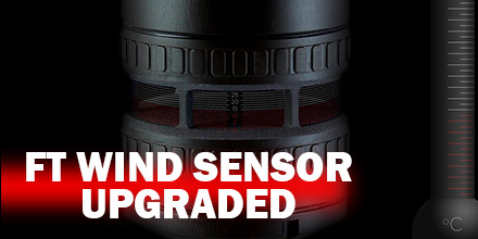 Recently, FT Technologies updated the 722 and 742 digital wind sensors.
Now, these models can read acoustic temperature as well as wind speed and wind direction.
The air temperature is derived from the operating frequency of the sensor. It has an accuracy of ±1°C.
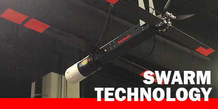 Raytheon‘s BBN Technologies announced it is developing technology to direct and control swarms of small, autonomous air and ground vehicles.
This technology falls under DARPA’s Offensive Swarm-Enabled Tactics program.
The technology includes:
 Battery life.
This continues to be one of the biggest challenges for drone operators.
Currently, the average flight time of most consumer drones is limited to around 20 minutes. Of course, this number varies depending on many things - weather conditions, payload, etc.
Ultimately, though, battery life continues to be a challenge for long flight operations. Eventually, a drone must return and recharge or switch out batteries before operations can continue.
Battery manufacturers, of course, continuously work to improve battery technology. But, there may be a completely new solution on the horizon...hydrogen fuel cells.
Recently, researchers in Sydney, Australia, successfully conducted UAV test flights using hydrogen-powered fuel cells. The results were promising.
 In recent years, it’s fair to say that drones have come a long way in terms of mainstream acceptance.
From the initial skepticism of both the ordinary public and commercial entities, drones moved beyond niche hobbyists to one of the most in-demand technologies.
Now, the technology is disrupting the road construction industry, as well.
