Author - Pamela

Aeromapper Talon Completes Single-Flight Survey of Island in The Maldives

https://www.unmannedsystemssource.com/?s=aeromapper&post_type=product&product_cat=0In December Aeromao Inc., completed a full photogrammetric survey mission of an island with an Aeromapper Talon UAV...in one flight. The survey took place in collaboration with Foresight Surveyors. One of the most unique and exotic islands in the Maldives, the Talon surveyed a total area of approximately 251 acres or 1 Sq. Km. at a GSD of 2cm/pixel.
 

Talon Surveys Island

The Talon UAV flew at a cruise altitude of 100 m AGL and collected 1422 photos with an amazing level of detail. Pix4DMapper software generated a DSM, orthophoto and point cloud. Though the Aeromapper Talon has 2 hour flight endurance capability, the mission finished successfully in only 45 minutes. The UAV flew at a maximum distance from the ground control of 2km. Additionally, the Talon launched and was recovered via parachute from an island roughly 1 km away. The UAV flew without incident. The Aeromapper Talon was not equipped with PPK GNSS system, so 5 GCS points were taken on the island which resulted in a horizontal accuracy of 4.8cm  

The results

The purpose of the survey was to generate an ortho-photo to trace the "as-built" for future developments. Furthermore, the data provided clients with an up-to-date high resolution property map for the project department and decision makers. Also, the othophoto helped with their environmental monitoring and biodiversity mapping.
 

About the Maldives

The Maldives consists of 1,192 coral islands grouped in a double chain of 26 atolls. It spreads over roughly 90,000 square kilometers (35,000 sq mi) and is one of the world’s most dispersed countries. It lies between latitudes 1°S and 8°N, and longitudes 72° and 74°E. Composed of live coral reefs and sand bars, the atolls rise abruptly from the Indian Ocean. These islands are situated on a submarine ridge 960 kilometers (600 mi) long. Maldives is the lowest country in the world. As a result, its natural ground levels average only 2.4 meters (7 ft 10 in) and 1.5 meters (4 ft 11 in) above sea level. However, in areas where construction exists, ground levels have increased several meters.  

About Foresight Surveyors

The first company to introduce unmanned aerial vehicle mapping to the Maldives, Foresight Surveyors chose the Aeromapper Talon because of its ease of use, dependability and affordability. Foresight Surveyors provides a comprehensive range of surveying and survey related consultancy, including: topographical, bathymetry and engineering survey services. The company makes use of traditional techniques and modern technologies to produce accurate data.  

About Aeromao, Inc.

Founded in 2011, Aeromao Inc. is a leading manufacturer of UAVs. Aeromao developed the Aeromapper series of turnkey unmanned aerial vehicles for mapping, surveying, precision agriculture and remote sensing. Canada serves as the company's headquarters. Aeromao Inc. offers a line of products that adapt quickly to market demands and the unique needs of client applications. You can shop the entire line of Aeromapper UAVs at Unmanned System Source.

Ground-based delivery drones: set to cruise the sidewalks?

Ground-based delivery dronesCompanies from various sectors envision a future driven by artificial intelligence (AI) and automation. So far, much of the attention seemed focused on developing unmanned aerial vehicles. But not every company looked only to the skies...some had more terrestrial ideas in mind. Enter Starship Technologies, a start-up based in Estonia. The team at Starship created a line of autonomous ground based courier robots, or sidewalk delivery drones.  

Ground-based delivery drones

In recent months, both Amazon and Fed-Ex previewed their ideas about the future of package delivery via aerial drones. But these efforts face many challenges, the foremost of which is regulation. Other obstacles include the roll-out of this technology on a nationwide basis requires mass investment as well as consumer uptake. But there is little doubt that there is a strong appetite for reliable delivery solutions. And, finding an efficient way to automate the courier process is of great interest to numerous companies. Many companies are competing within this space to find the best solution. On the other hand, sidewalk delivery drones are already legal in a number of states. Starship Technologies focused on utilizing current infrastructure and new technologies, such as on-demand services, to bring goods to customers now. To launch its sidewalk delivery drones, the start-up partnered with logistics company Postmates to deliver food in Washington D.C. Starship also partnered with on-demand restaurant delivery service, DoorDash, to service customers in Redwood City, Calif. Starship calls its sidewalk delivery drone a “personal courier” and is designed to deliver small parcels within a 30-minute range. It is compact, about knee-high, and reaches speeds up to 4 miles per hour. For a delivery run, the personal courier travels on sidewalks and is outfitted with sensors and cameras so it can autonomously avoid obstacles. Customers access the contents of the delivery via an app.  

Pilot programs already in progress

Starship's technology is already legal in a number of states. Currently, pilot programs are operating in Virginia, California and Washington. In Virginia, the law allows the robots to operate on footpaths, sidewalks and crosswalks. The delivery drones are not permitted to travel over 10 mph and require remote access monitoring by operators. During the test phase, the delivery robots must make up to 10 deliveries a day and be accompanied by monitors to observe behavior and performance. Starship’s pilot programs with DoorDash and Postmates provide real-world practice and help work out the kinks. So far, the process is pretty cut and dry. A customer places an order, either online or via an app. The restaurant completes the order and loads the drone with the delivery. The drone proceeds to the delivery address.  

Seasoned creators

Founders Ahti Heinla and Janus Friis Visualise are former Skype co-founders. Starship is just their latest start-up to gain mainstream recognition. So far, the start-up has received millions of dollars in backing from a number of Venture Capital investors. In a sector that is still relatively young, Starship Enterprises has quickly become a pioneer in urban, on-demand delivery. Heinla and Visualise envision a future where delivery drones are a regular sight and responsibly share sidewalk space with pedestrians. In addition to the pilot programs in Washington and Redwood, the start up has made deliveries in over 40 European cities including London, where Starship partnered with JustEat. While Starship’s sidewalk delivery drones may not be the super speedy aerial solution that other retailers are seeking, the robots are currently a solid solution for deliveries in urban areas. Currently, these delivery robots are a great way to complement both human couriers and aerial drones, when they become approved. For now, Starships’s sidewalk robots are rolling ahead in the delivery drone race.

Phase One announces full integration of aerial cameras with DJI’s M600 and M600 Pro

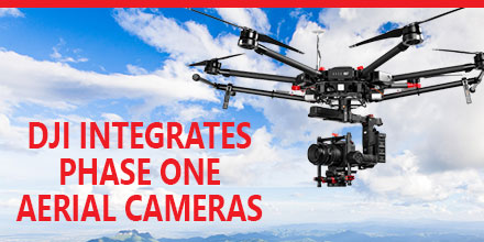
Phase One Industrial recently announced the full integration of its iXU and iXU-RS aerial cameras with DJI’s M600 and M600 Pro drones. Built using DJI’s SDK, this is just the latest drone platform supported by Phase One Industrial. Phase One was the first to deliver 100-megapixel medium format aerial cameras. Since then, Phase One has continued to innovate inspection tools uniquely capable of addressing diverse aerial imaging applications. Those applications range from photogrammetry to critical infrastructure to monitoring projects.  

High quality solution for aerial imaging applications

The aerial cameras’ integration with DJI’s M600 and M600 Pro platforms is delivering high quality solutions for aerial imaging applications. “Using the Phase One Industrial IXU camera with the new Integration package for our DJI M600 drone, the results were extraordinary,” said UAV Flight Systems Manager Tobias Wentzler, Lufthansa Aerial Services. “We achieved millimeter per pixel accuracy, allowing us to inspect the required objects in exquisite detail and lift our mission results and accuracy to a new, high-end level, identifying the subtlest cracks or imperfections that were not visible to conventional inspection methods.” Phase One continues to develop aerial imaging solutions that meet the exacting needs of aerial imaging professionals. “When our clients hire us, they expect the best,” said Ron Chapple, CEO of Aerial Filmworks. “With the new Phase One Industrial aerial cameras integrated with DJI drones, Aerial Filmworks delivers robust performance, highest resolution and finest image quality to support our clients’ cinematic projects. “GEO1, the survey division of Aerial Filmworks, a solutions-driven provider in the electric and gas/oil marketplace, also benefits from this development. Now, we have the right solution to help satisfy our clients’ requirements for the high-resolution data and flight efficiencies.”  

Capabilities include

Phase One Industrial iXU and iXU-RS aerial cameras’ integration with DJI M600 and M600 Pro drone systems include:
  • 100MP and 50MP metric aerial cameras
  • Smart triggering of the camera by waypoints / fixed distance / fixed time
  • Support for mission planning applications (such as DJI Ground Station pro) – for waypoints missions
  • Geo-tagging of all files’ location and gimbal position
  • Dual remote controllers (drone and camera) enable each operator (UAV pilot and camera operator) to focus on their respective mission goals
  • Industrial-grade build of the camera and aerial lenses for use in harsh environments
Also, the integration provides a new iX Capture Mobile application for iOS. This application features an intuitive, user-friendly interface, and support for total remote control of the camera.  

Phase One DJI Integration

Designed using the DJI open platform development tools, iX Capture Mobile offers various operating modes, including:
  • Video Streaming
  • Auto or Manual Capture settings to determine the values of the ISO, shutter speed and aperture
  • Auto capture mode to enable image capturing by waypoints, fix distance or by time intervals
  • Camera control via DJI Lightbridge 2 dials
The iXU and iXU-RS series of high-resolution, metric cameras are known for precision imaging, small size and low weight. In addition, these cameras offer direct integration with other UAV manufacturers, including: Coptersystems, AerialTronics, Pulse Aero, and UMS Skeldar platforms. They also support the workflows of many leading image post processing software, such as: Pix4D, Agisoft, SimActive, and others. Designed to capture images with superior accuracy and quality, Phase One Industrial aerial cameras are capable of covering larger aerial surfaces in less time, resulting in less flight time needed for efficient flying. As such, operators can enjoy both unprecedented visibility and a lower cost by utilizing drones rather than traditional airplane or helicopter methods. In addition, drones offer improved worker safety across challenging environments, including: power line monitoring, inspection of wind turbines, railways, roads, bridges and other civil engineering jobs. Phase One iXU and iXU-RS series camera systems are available immediately from partners worldwide, including Unmanned Systems Source. Camera package prices begin from $29,000 (complete with integration kit and lens). For more information, please contact Unmanned Systems Source.

Visit Booth 325 at XPONENTIAL to meet the Unmanned Systems Source Team

May 9, 2017 – Unmanned Systems Source is looking forward to connecting with clients, vendors and friends May 8-11 at the XPONENTIAL show in Dallas, TX. Unmanned Systems Source provides users a single source of supply and information for unmanned and remote sensing applications. “We are often referred to as the ‘Amazon’ of the Unmanned world,” said Jennifer Jerrick, CEO of Unmanned Systems Source. “Prosumers, developers, manufacturers, and procurement agents, alike, can find what they need to outfit their unmanned projects. We are a one-stop-shop.” Unmanned Systems Source, though, is more than just an e-commerce site.  

Industry experience, customer support

“The level of service and support our team provides customers is one of the key factors that distinguishes us within the marketplace,” said Jerrick. “Our industry experienced Solution Engineers listen, answer questions and help customers select the right systems, payloads and peripherals for their application.” Thanks to numerous distribution partnerships with recognized manufacturers, the product offering at Unmanned Systems Source continues to grow. Customers can shop, compare and buy top-tier products at retail pricing…or better.  

About Unmanned Systems Source

Unmanned Systems Source is an online warehouse that supplies unmanned systems, components, subsystems, and services. With more than 30 years combined experience, the team at Unmanned Systems Source has the insight to help power projects for commercial, governmental, and public sectors, alike. Visit booth 325 to find out how Unmanned Systems Source can create buying and procurement solutions for your projects.

AsteRx-m2 UAS ultra-low powered GNSS receiver offers unmatched jamming robustness

AsteRx-m2 UASMay 8, 2017 - Septentrio, a leading manufacturer of accurate and reliable GNSS solutions, announced the release of the AsteRx-m2 and AsteRx-m2 UAS OEM boards. These OEM boards bring the latest in GNSS positioning to the market with unmatched interference mitigation technology all on ultra-low-power. Septentrio will showcase these OEM boards in Dallas, Texas at AUVSI's Xponential 2017.  
Centimeter-level RTK position accuracy, and more

The credit-card sized AsteRx-m2 and the AsteRx-m2 UAS offer all-in-view multi-frequency, multi-constellation tracking and centimeter-level RTK position accuracy for the lowest power of any comparable receiver. Additionally, the AsteRx-m2 and the AsteRx-m2 UAS can receive TerraStar satellite-based correction signals for PPP positioning. Also, both boards feature Septentrio’s AIM+ interference mitigation system: the most advanced on-board interference mitigation technology on the market. It can suppress the widest variety of interferers, from simple continuous narrowband signals to wideband and pulsed jammers. Increased levels of radio frequency pollution coupled with the intrinsic danger of self-interference in compact systems such as UAS, makes interference mitigation vital to any UAS GNSS system.  

AsteRx-m2 UAS for unmanned systems

The AsteRx-m2 UAS is designed specifically for unmanned systems. It brings plug-and-play compatibility for autopilot software such as ArduPilot and Pixhawk. And event markers can accurately synchronize a camera shutter with GNSS time. In addition, the board can receive power directly from the vehicle power bus via its wide-range power input. The AsteRx-m2 UAS works seamlessly with GeoTagZ software and its SDK library for RPK (ReProcessed Kinematic) offline processing to provide RTK accuracy without the need for ground control points or a real-time datalink. “The market demands increasingly accurate and reliable GNSS positioning systems for inspection, mapping and aerial survey” stated Gustavo Lopez, Product Manager at Septentrio. “Septentrio’s answer is the AsteRx-m2 and the AsteRx-m2 UAS. They offer multi-frequency and multi-constellation tracking as well as robust interference protection all for the lowest power on the market.” If attending XPONENTIAL, find out more about the AsteRx-m2 UAS by stopping by Septentrio's booth, #749, or Unmanned Systems Source at booth #325.  

About Septentrio

Septentrio designs, manufactures and sells high-precision multi frequency multi constellation GPS/GNSS equipment. Receivers, designed by Septentrio, deliver consistently accurate GNSS positions scalable to centimeter-level. They perform solidly even under heavy scintillation or jamming. Receivers are available as OEM boards, housed receivers and smart antennas. Shop Septentrio's line of GNSS receiver solutions at Unmanned Systems Source.

Silvus to release SC4400 MIMO Radio designed for unmanned system applications

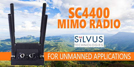
SC4400 MIMO RadioSilvus Technologies is preparing to showcase its new StreamCaster 4400 radio at the upcoming AUVSI XPONENTIAL show in Dallas, TX. The SC4400 is a 4×4 MIMO radio designed for unmanned systems applications. It transmits high-definition video, data and communications at near zero latency over long distances. Also, it can deploy as a point-to-point data link or as part of a comprehensive, self forming/self healing mesh network. And it intelligently optimizes signal transmission in both line-of-sight and non-line-of-sight operations.  

SC4400 Mimo Radio

The SC4400 MIMO Radio utilizes four antennas for true 4×4 MIMO. It comes equipped with standard connections including: Ethernet, USB, Push-To-Talk voice, RS-232 and a Wi-Fi port for connecting a phone, tablet or laptop to access the StreamScape user interface. This comprehensive network manager allows users to monitor signal strength, data rates and radio stats, and to test links and make adjustments. The spectrum scan diagnostic tool enables the user to analyze the available range of frequencies and select a channel that is free of interference. An embedded mapping display also enables nodes to be tracked in real time, providing a bird’s eye view of the entire system. “The StreamCaster 4400 delivers a significant increase in range and overall robustness, making it a great fit for larger aircraft,” said Silvus Technologies Director of Sales, Kasey Cooper. “Our existing StreamCaster 4200 radio is also getting an upgrade with dual band capability, providing the ability to tune across two disparate bands for maximum reliability in a smaller form-factor. Together, the StreamCaster 4200 and the more powerful StreamCaster 4400 can combine to optimize video, command and control and bi-directional data transmission for UAVs of any size, in any range.”  

About Silvus Technologies

Silvus Technologies develops military-grade Mobile Networked MIMO (MN-MIMO) waveform technology, which comprises the core of the SC4400 MIMO Radio. Its distinctive beam-forming ability boosts signal strength, reducing power consumption while increasing overall range. Silvus claims that the SC4400 is the world’s first tactical MIMO radio to employ 4×4 MIMO transmit beam-forming, an advanced method of signal processing that is capable of doubling transmission distance reach. MIMO’s tenacious ability to bounce off obstacles and reroute signals also features prominently in the SC4400. “We’ll be performing live demos on the show floor to give just a small taste of the kind of wireless connectivity we can achieve,” added Cooper. “We’ll be showing how our StreamCaster radios operate with the latest UAVs and subsystems from Overwatch, Latitude and Isensys, to name a few.” If you're attending XPONENTIAL, stop by booth 518 to watch Silvus Technologies demo the SC4400. And make sure you stop and visit Unmanned Systems Source at booth 325. You can shop Silvus' line of MIMO radios at Unmanned Systems Source.